


GPS Satellite Earth Map View
3.3171.00 Reviews
App Specs
- Version
- 2.0.32
- Updated On
- License
- Free
- Downloads
- 10,000,000+
- Developer
- Soft Clicks
- Categories
- Maps & Navigation
- Platform
- Android
Screenshots

 Analysis by AppCompare
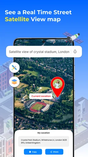
I find GPS Satellite Earth Map View most useful when I want to inspect a place before deciding where to go, rather than when I need turn-by-turn directions every minute. Looking at a destination from above can answer practical questions a street address cannot: whether a park has more than one entrance, how a neighborhood sits beside a river, or whether a hotel appears close to the shoreline or separated from it by roads. That kind of visual context is the app’s appeal, and it makes the experience feel different from simply typing an address into a conventional navigation tool.
Where it fits in a mapping routine
I would treat this as a visual exploration and planning app, not as an automatic replacement for a dedicated navigation service. A familiar maps app is usually the better choice when I need dependable directions, traffic-aware routing, transit details, or a quick answer while driving. Earth Map’s satellite-first approach makes more sense when I have time to look around, compare the layout of a few places, and build a mental picture before setting out.
That distinction matters because an overhead image can be informative without answering every navigation question. It may help me understand the shape of a site, but it does not tell me by itself whether a path is open, a gate is accessible, or a route is suitable for a particular vehicle. I use imagery as a planning aid and check important travel details separately instead of assuming that a striking map view is the same thing as current, complete local guidance.
A useful preview before leaving home
A realistic use is planning a weekend visit to an unfamiliar public attraction. Before heading out, I can search for the area, zoom out to understand its surroundings, and then inspect the location more closely. I might notice a nearby road, a cluster of buildings, or a broad open area that helps me orient myself when I arrive. If I am meeting someone, comparing the general setting also gives us a better chance of agreeing on the right part of a large site than relying on a vague place name alone.
My practical tip is to do that inspection while connected to a stable network and allow the imagery time to load before making a decision. The original review notes that high-resolution imagery can lag with weak internet, so I would not leave the first look until I am already standing outside with poor reception. I also would not rely on an image as proof that a small access road or footpath is currently usable; satellite views can be helpful context, not a live report from the ground.
Who will get the most from it
This app is a good fit for curious travelers, people who enjoy exploring places from home, and trip planners who think visually. It can be especially handy when choosing between possible meeting points or getting a broad sense of an area before a visit. The free price makes it easy to try for casual use, while the Everyone age rating means it is presented for a general audience.
I would be less inclined to recommend it as someone’s only map if their daily routine depends on highly specific directions or current road conditions. People who need a polished, all-purpose navigation workflow may prefer the map app they already trust, using this one only when satellite imagery adds something useful. Hikers should also avoid treating a GPS position as a substitute for a proper route plan, local trail information, and sensible offline preparation.
Worth Reading Before You Choose

Flipboard Shows What News Apps Must Do Beyond the Feed

Switching to Android Auto Means Rethinking Your Driving Routine

Google Calendar Makes a Crowded Week Easier to Manage

Ludo King Makes the Most of the Minutes Between Plans

Baby Panda World Brings Quick Play to Modern Phones, but Its Game Library Feels Busy

ESPN’s Live Game View Makes Following Close Games Easier
Small workflow choices that improve the experience
One useful way to work with a satellite map is to start broad and then zoom in gradually. Beginning at neighborhood scale gives landmarks and road patterns some context; jumping straight to a close view can make it harder to tell where you are. Once I have found the area I care about, I can use the app’s location and planning tools as a second step rather than trying to do everything in one search.
For a trip with several stops, I would check each place individually and keep a separate note of the order and any details that matter. The app is described as supporting marked locations, routes, and distance measurement, but I would still verify the final journey with a navigation tool suited to the day’s travel. That split workflow is a small trade-off: it takes a little more effort, but it reduces the risk of mistaking a visual preview for a complete itinerary.
Location sharing deserves the same practical care. It can be useful when coordinating a meetup or letting someone know where you are, but I would share only with people who need the information and only for the purpose at hand. Before relying on it outdoors, I would check that location access and connectivity are working as expected. GPS can help orient you, but buildings, terrain, and signal conditions can affect how confidently any phone-based map reflects your position.
For a quick comparison, the usual map alternatives tend to center on directions and everyday travel tasks, while Earth Map puts more emphasis on looking at places from above. That difference is valuable for visual reconnaissance, but it also means I would not assume every feature works as a full substitute for a dedicated navigation app. If my main question is “How do I get there right now?”, I reach for conventional turn-by-turn guidance. If it is “What does this area look like, and how is it laid out?”, this app has a clearer role.
What the current release tells me
Soft Clicks has kept the app in a continuing versioned release, with version 2.0.28 as the current version. It was released on March 19, 2018, and its present version number is a concrete sign that the product has moved beyond its original launch build. That history is useful context, but a version number alone does not tell me which individual features changed or how much the interface has evolved, so I judge the app by what it offers now rather than guessing at a changelog.
The audience around it is substantial enough to make it more than an obscure experiment: it has over five million installs and an average rating of three and a half from around nine thousand ratings. Those figures suggest broad interest alongside mixed experiences, which feels consistent with a tool whose usefulness can depend on connection quality and on whether someone wants exploration or precise navigation. I would read the rating as a reason to try it with realistic expectations, not as proof that it will suit every mapping need.
Costs, expectations, and the decision to install
The app is free to download, with in-app purchases listed from about ten to thirty-three dollars per item. I would first decide whether its satellite views and planning workflow are useful in my own routine before considering any purchase. In particular, I would check what an in-app item offers on the purchase screen and whether that benefit addresses a real need for me; the listed price range alone is not enough to decide that it is worthwhile.
My recommendation is therefore specific: try it if you enjoy exploring locations visually or want a companion for early-stage trip planning, and keep your regular navigation option available for the actual journey. Skip it if you expect one app to provide every direction, local detail, and outdoor safety check without any verification. Used with that boundary in mind, Earth Map can make the world feel easier to inspect before you go, while leaving the final travel decisions in your hands.
Getting Started with GPS Satellite Earth Map View
Diving into the GPS Satellite Earth Map View app is pretty straightforward. Once you've downloaded it, you're greeted with a sleek interface that's easy to navigate. The app doesn't bombard you with ads right off the bat, which is a major plus. I appreciate how it allows you to jump right into exploring without unnecessary distractions.
Exploring the Features
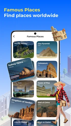
The app's main draw is its satellite imagery, which is both detailed and accurate. You can zoom in on any location globally and get a crystal-clear view. Whether you're planning your next vacation or just curious about far-off lands, this app has you covered.
One feature I found particularly impressive is the real-time GPS tracking. It's handy for those of us who love hiking or exploring new cities on foot. The app tracks your location accurately, ensuring you never get lost. Plus, you can easily share your location with friends and family, adding a layer of security to your adventures.
User Experience and Interface
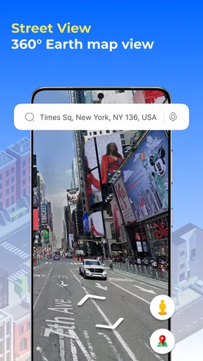
Navigating through the app is a breeze. The developers have done a great job maintaining a clean design with intuitive controls. The search function is robust, allowing you to find locations quickly. I also love the 3D view option, which gives a more immersive experience, making you feel like you're actually there.
The app's performance is generally smooth, though I did notice a slight lag when loading high-resolution images in areas with weak internet connectivity. But that's a minor hiccup considering the wealth of information the app provides.
Practical Applications
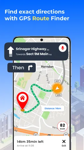
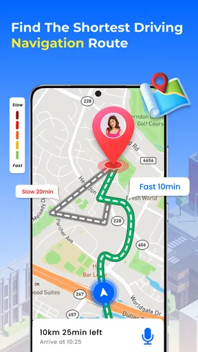
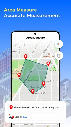
Beyond just exploring, the app is a practical tool for planning trips. You can mark locations, create routes, and even measure distances. It's like having a digital map and planner in one place. For someone like me who loves organizing every detail of a trip, this feature is a game-changer.
Additionally, the app offers weather updates, which is crucial when planning outdoor activities. It’s convenient to have all this information bundled together, saving you the hassle of jumping between different apps.
Privacy and Security
In today's digital age, privacy is a big concern, and rightly so. The app respects your privacy and doesn't require intrusive permissions. You're in control of what you share and with whom. This builds a level of trust that's essential for any app that uses GPS tracking.
Final Thoughts
All in all, GPS Satellite Earth Map View is a robust and versatile app. It's perfect for explorers, travel planners, or anyone curious about the world. While it has a few minor performance hiccups, the benefits far outweigh them. If you're looking for an app that offers detailed satellite imagery and practical planning tools, this app should definitely be on your download list.
So, next time you're dreaming about your next adventure or simply want to explore the world from your couch, give this app a try. I guarantee you'll find yourself lost in a good way.
Pros
- High-resolution satellite imagery.
- User-friendly interface for easy navigation.
- Real-time traffic updates available.
- Offline maps for convenience.
- Multiple map view options.
Cons
- Consumes a lot of data usage.
- Some areas lack detailed maps.
- Frequent ads in the free version.
- Limited features without premium.
- Occasional GPS signal lag.
FAQs for GPS Satellite Earth Map View
What features does GPS Satellite Earth Map View offer?
GPS Satellite Earth Map View provides real-time satellite imagery, detailed street maps, and 3D terrain views. Users can explore landmarks, track their location, and access navigation tools. The app also includes features like route planning, traffic updates, and offline maps, making it versatile for both casual exploration and professional use.
Is GPS Satellite Earth Map View available offline?
Yes, GPS Satellite Earth Map View offers offline functionality. Users can download maps for specific areas to ensure access without an internet connection. This feature is especially useful for travelers and those in remote locations, allowing them to navigate and explore without relying on mobile data or Wi-Fi.
How accurate is the location tracking in GPS Satellite Earth Map View?
The app utilizes advanced GPS technology to provide highly accurate location tracking. It integrates with your device's GPS to pinpoint your position with precision. However, accuracy can vary based on factors like signal strength, environmental conditions, and device settings. For best results, ensure your GPS settings are optimized.
Are there any subscription fees or in-app purchases in GPS Satellite Earth Map View?
While GPS Satellite Earth Map View is free to download, it may offer in-app purchases or subscriptions for premium features. These could include enhanced map details, additional satellite imagery, or ad-free experiences. Check the app’s store listing for detailed pricing information to understand any costs involved.
Is GPS Satellite Earth Map View compatible with all devices?
GPS Satellite Earth Map View is compatible with most Android and iOS devices. However, performance may vary depending on your device's specifications and operating system version. It's advisable to check the app requirements on the Google Play Store or Apple App Store to ensure compatibility with your device.


